Furuno Satellite Compass

High accuracy Satellite Compass with a compact 2-sensor antenna. Uses GPS, Galileo and/or GLONASS satellite systems to ensure the highest precision and coverage. 0.4 degree course accuracy
| Part Number | SC70 |
|---|---|
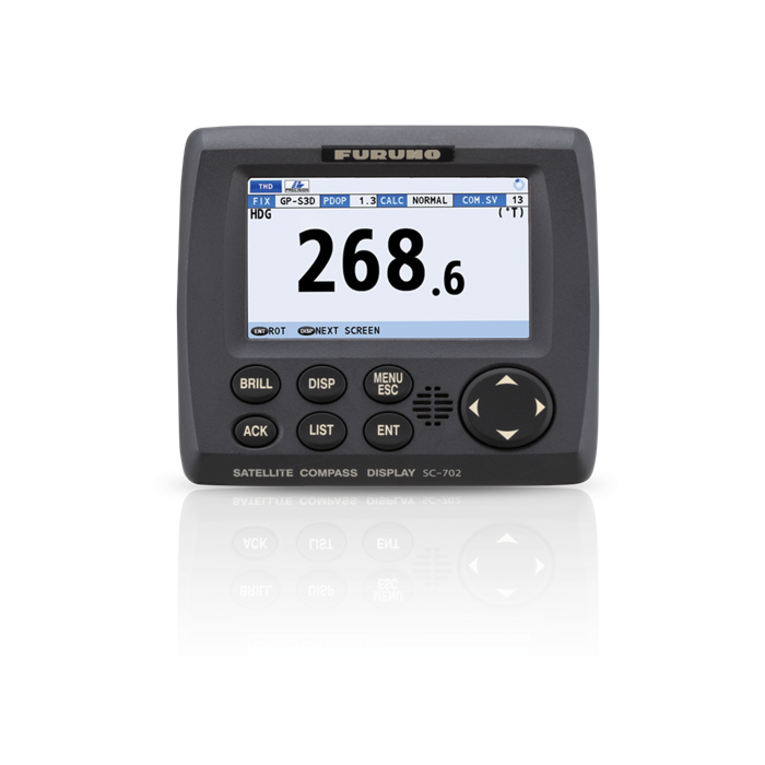
| Features | Precise and accurate HeadingThe SC70 and SC130 are the latest satellite compasses built on FURUNO’s commercial-grade technology platform. These satellite compasses prove their value by increasing the accuracy of other devices, such as Radar, ARPA, Scanning Sonar, Current Indicator, Chart Plotter, ECDIS and Autopilots. They provide a highly accurate heading input to these other technologies by utilizing the very latest GNSS (Global Navigation Satellite System). This satellite system is comprised of GPS, Galileo and GLONASS to ensure the highest precision and a continuous coverage. 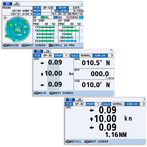 Bow and Stern monitoring for safe berthing The Satellite Compass provides a variety of data, including GPS Positioning, SOG (Speed Over Ground), COG (Course Over Ground), ROT (Rate Of Turn) and 3-axis speed (bow, stern and longitudinal). All of these data assist with critical maneuvers, such as berthing. The Compass is maintenance-free - a great asset for any vessel - and connects easily into the existing shipboard network via Ethernet connection. 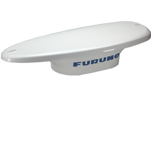 IMO Type Approved as THD, GPS and ROTIThe SC70 provides highly accurate heading data of 0.4° for autopilot, Radar, ARPA, Scanning Sonar, Current Indicator, Chart Plotter, ECDIS and Autopilots. It is ideal for small to medium boats requiring highly accurate heading, and is IMO Type-approved as THD, GPS and ROTI, complying with the IEC/ISO requirements. It features a rapid follow-up rate 40°/s, twice the IMO high-speed craft requirement of 20°/s. |
| Specs | Data Type NMEA0183 Display Size 4.3 inches Display Type Color LCD |
| Brand | Furuno |